Pages: [1]   Go Down
Print
Author Topic: The Ox Wagon Route  (Read 9329 times)
0 Members and 6 Guests are viewing this topic.
Trailrider
Administrator
Town Crier
*****
Offline Offline

Posts: 26585


Die Bergie...


WWW
« on: November 01, 2012, 08:51:46 AM »

"It is, perhaps, not just the journey that counts, but also the road that is travelled. And it's not necessarily the high road or the low road that matters, but rather the story behind the road that's important."

From early days a need for a link between the coast and the interior existed. With the arrival of white settlers at the Cape, the need for a route between the Cape and the interior enjoyed a high priority. But it was a time before great road builders like Bain came along and traveling over the mountains of the Southern Cape was all but impossible. It took a special kind of person, a pioneer, explorer and adventurer all in one, to look for and navigate new routes over these treacherous mountains.

Today when we travel on the routes these remarkable individuals opened up, we do so in luxury with little effort and in a fraction of time. They did it with great danger to themselves. We do it as a pastime or a holiday. But lets never forget the remarkable achievements of those that has gone before. We honour them by keeping the history alive.


The Ox wagon Route in the Southern Cape is a modern day route, connecting various historic passes and routes that the ox wagons of old had to conquer.

The route travels over various mountain ranges and 4x4 tracks following in the footsteps of the first Pioneer Trekkers. The area is blessed with amazing natural beauty and that in itself makes it worth traveling, but if you do not travel informed you miss out on so much as it's rich history truly makes this a route to remember.

I have done portions of this route before on my motorbike, but some areas on this route is off-limits to motorbikes for various reasons. Having access to vehicles of all kinds I decided to tackle this route again on four wheels, like the ox wagons of old did.

This report will be divided up in sections and will be updated as I go along. Hopefully it will be of some use to 4x4 enthusiasts visiting our wonderful area.


(Click on Map to enlarge)

Map from Katot Meyer's website here.
Logged

“Remember what Bilbo used to say: It's a dangerous business, Frodo, going out your door. You step onto the road, and if you don't keep your feet, there's no knowing where you might be swept off to.”
Trailrider
Administrator
Town Crier
*****
Offline Offline

Posts: 26585


Die Bergie...


WWW
« Reply #1 on: November 01, 2012, 08:52:15 AM »

The Ox Wagon Route starts near Heidelberg in die Western Cape from where it crosses the Langeberg mountains via Gysmanshoek Pass into the Klein Karoo.

Gysmanshoek Pass, or Plattekloof Pass as it was also known, was opened up in 1740 by the Trekboers (migrant farmers). It was well used and even mentioned by famous explorers William Burchell and the botanist Carl Thunberg in their travel diaries.

The historic pass lies between way-points S33 58.220 E21 03.085 in the south and S33 53.468 E21 03.604 in the North.

It is an easy start to the Ox Wagon Trail as Southern Cape passes go, but interesting nonetheless. It runs through three farms, Plattekloof in the South, then Kanetberg and Kortfontein on the Karoo side.

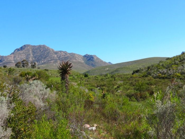
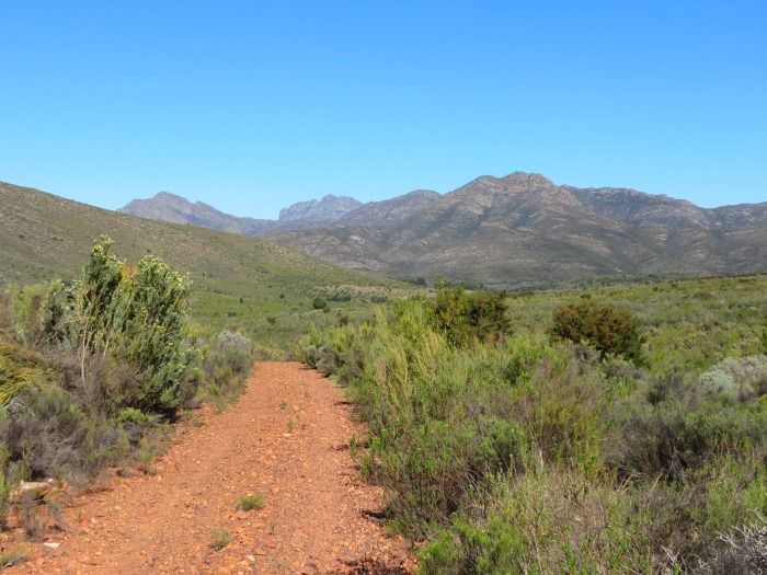
The scenery and flora changes dramatically as to cross to the Northern slopes turning into typical fynbos and eventually Karoo vegetation. The Southern portion though is lush and green:


But that changes soon as you start to enter the mountains.


The track is generally in good condition and once in the mountains you are alone with little or no signs of civilization around. Just the way I like it.

Looking back - notice the contrast, how much greener the side facing South is:


Gysmanshoek Pass runs through this gentle valley, a very easy road to build in those times. And yet, about 120 years after this route to the Klein Karoo opened they chose to build the Tradouw pass, a massive undertaking over very challenging terrain, instead of upgrading Gysmanshoek Pass. It almost makes no sense until you consider what it was like in the days of animal drawn vehicles.

When the inhabitants of Swellendam wished to get to the Little Karoo on the other side of the Langeberg they had to travel either via Cogmans Kloof 50 kilometres to the west, or via Gysmanshoek, 30 kilometres to the east. Huge distances in those days worth days of traveling time. This of course also applied to Little Karoo farmers who wished to transport their produce to Port Beaufort on the Breede River, which Joseph Barry had opened to shipping in 1841.

After the construction of the Tradouw and Garcia's passes in 1873 & 1877 respectively, Gysmanshoek Pass fell in disuse. It came in handy for a Boer Commando during the Anglo-Boer War though, when they used Gysmanshoek Pass to flee back to the Karoo after attacking the headquarters of the West Yorkshire Regiment at the Masonic Hotel in Heidelberg on the 14th of September 1901.

Today the road is seldom used, mostly by local farmers.


William Patterson wrote about crossing the Langeberg in 1777. He commented in his journal: "Upon reaching the summit of the mountain, we were presented to the south with a view to the sea, and on the North... the Channa Land and Karoo."


Looking back at the pass from the Karoo side:


Not the most challenging pass you'll encounter, but the remoteness and solitude will more than make up for that. You are unlikely to encounter other traffic on this pass. I never have.

From here you continue East on well maintained gravel roads along the Langeberg mountains to the Gouritz river and beyond to the next portion of the Ox Wagon Trail - Attaquaskloof.

Logged

“Remember what Bilbo used to say: It's a dangerous business, Frodo, going out your door. You step onto the road, and if you don't keep your feet, there's no knowing where you might be swept off to.”
Trailrider
Administrator
Town Crier
*****
Offline Offline

Posts: 26585


Die Bergie...


WWW
« Reply #2 on: November 01, 2012, 08:52:59 AM »

The gravel R327 takes you over Gouritz River and on to Cloetes Pass and eventually Herbertsdale. Before you reach Cloetes Pass though you have to turn East towards Attaquaskloof as indicated by the little Ox Wagon sign, but it's easy to miss:


The coordinates of the turnoff is: S33 54.373 E21 42.696.


On this section I am joined by Kane in his Hummer who will follow Gryph and myself in an Arctic Hilux.

We have not met Kane before, but after introductions and some 4x4 talk it was soon clear that we would get along famously. Kane also has not done this section of the route before so luckily he did not mind my many photo stops at all. And there were many. It's such a scenic area.


No fences, no other traffic. Just a trail in Africa. This is the type of thing I love.


The road ahead:


Imagine travelling here with an ox wagon without a maintained road.


Moving into the kloof you move up and over hills constantly, which makes for excellent views. This also caused constant stops as each of us was armed with a camera. The next hill:


And the view back form the hill:


This valley was first inhabited by the bushmen or Khoi San, who were present until the 1700’s as there are paintings of persons riding horses with rifles and hats on their heads. A fierce Khoi-Khoi tribe called the Attaqua also inhabited the valley (arriving after the San), hence the name Attaquaskloof.

The Attaqua were a particularly aggressive and violent tribe who not only drove the San out of the valley, but also clashed regularly with the other Khoi-Khoi tribes, such as the Gourikwa, Hessekwa and Inca, stealing their cattle and other belongings.

The first European to set foot in this valley would have been Ensign Isaac Schrijwer in February 1689. He led an expedition of 21 men and two ox wagons, sent by Simon van der Stel, to barter for cattle and sheep with the Inca Khoi-Khoi near Aberdeen. On their return with numerous cattle and sheep, they were attacked by the Attaqua Khoi-Khoi, who took all the cattle and sheep. The following morning Schrijwer followed the spoor and killed 41 Khoi-Khoi in Grootkloof. They returned to Cape Town with the animals they had bartered from the Incas, and the Attaqua’s cattle and sheep that they took after the attack. That was not the last blood that flowed in this kloof.

Isaac Schrijwer's route over Attaquas Pass opened up the inland and soon this valley was 'n busy trade route that flourished for 180 years. A town called Woeska was established and did brisk trade in this valley. The town was situated in the level green area just over that hill:


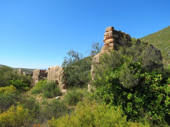
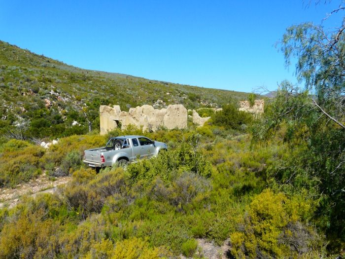
Some of the old buildings can still be seen here, though sadly it is not being looked after and in a worse state every time I pass here.


This spot is being farmed actively and the stones have been carted away, some used to build an animal enclosure.

Looking around where Woeska used to be:


And looking back from the hill on the other side:


Amazing to think that people lived and made a living here for more than a century, and today there is nothing left.

Some more scenery as we travel through the kloof:


And finally approaching Bonniedale Farm:


Bonniedale Adventure Farm caters for all kinds of activities including camping, 4x4 etc. It boasts several 4x4 routes and is 'n popular breakaway destination.

We got here later than planned and had to leave the pass for the next day. Today's route was scenic and interesting, but not technical at all. I spent most of the day in 2nd and 3rd gear and still got a fuel consumption figure of about 10km/L.

Since we were there we did have a quick look at some of the 4x4 routes. Can't have a trucks like this at your disposal and stay on good gravel roads.


Tomorrow we tackle Attaquas Pass:

Logged

“Remember what Bilbo used to say: It's a dangerous business, Frodo, going out your door. You step onto the road, and if you don't keep your feet, there's no knowing where you might be swept off to.”
cassiebotha
Forum Furniture
*****
Offline Offline

Posts: 2644


Pizza Boy!


WWW
« Reply #3 on: November 05, 2012, 07:18:17 AM »

Jislaaik!  Paar jaar gelede was dit bikes  (nogal awsome bikes as ek dit mag sê!)  Nou is dit Hummers en artic trucks!  Julle leef die lewe!!!

Logged

I smell a Pizza<br />I think about Pizza<br />I raaid oopketel and imagine myself eating a Pizza<br />I feel and fantasize about Pizza
Trailrider
Administrator
Town Crier
*****
Offline Offline

Posts: 26585


Die Bergie...


WWW
« Reply #4 on: November 28, 2012, 09:23:06 AM »

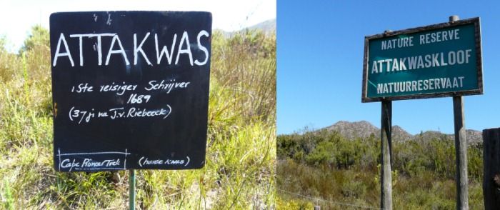
Attaquas Kloof Pass is the earliest recorded route linking the coastal area to the “Channa Land“ (Klein Karoo) across the Outeniqua mountains.

In 1668 an official of the VOC (Dutch East India Company), Hieronymus Cruze, led a trading company in the area. They investigated the possibility of a harbour in Mossel Bay. Cruze had contact with the Attaqua Koi “who lived in a mountain valley” (Attaquas Kloof), but it was not till 1689 (37 years after the arrival of Jan van Riebeeck) that the first white man stuck his nose over the Attakwas Pass into the Klein Karoo.

Isaac Schrijwer traveled along the coast to Mossel bay looking for cattle and sheep to buy. He remembered Cruze's report about the Attaqua Koi, but found that they had moved North into the Channa Land search of better grazing. He followed them out of the Kloof over the mountains following an elephant track. The area was densely overgrown and the elephant track had to be widened to take the wagons. This involved quite a bit of manual labour and the crossing took them seven days, four of which on this small section.

We finished so late the day before we could not cross Attaquas Pass, so we had to return for this leg of our expedition. Sadly Gryph could not join us today, so on this leg it would be just Kane and myself in the Arctic Hilux.

We start this section where we ended the previous day, on Bonniedale Adventure Farm where we obtain our permits and gate keys. This route runs through the Attakwas Nature Reserve and access is restricted.
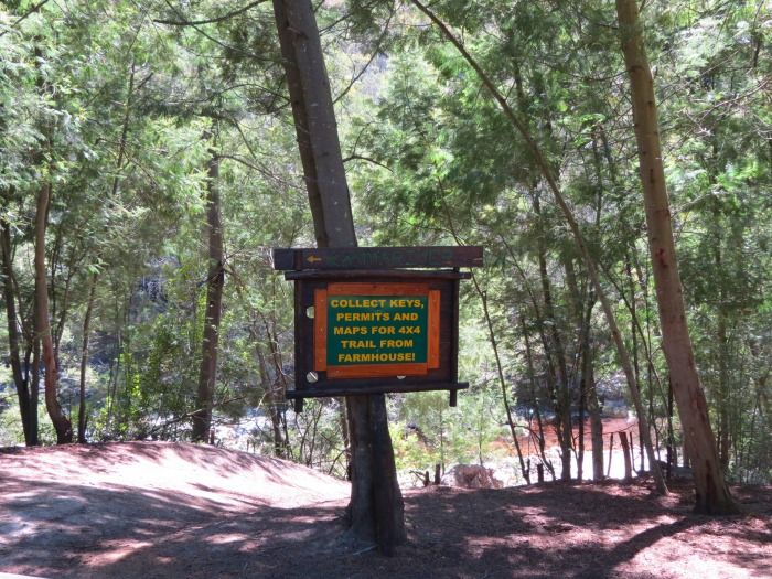


Nico and Danette Hesterman of Bonniedale is very helpful though and up to date with the currant status of the route, as well as all the history attached to the area.

And as it should be, the easy-going nature of the route ends today. Out trip literally starts in a riverbed.
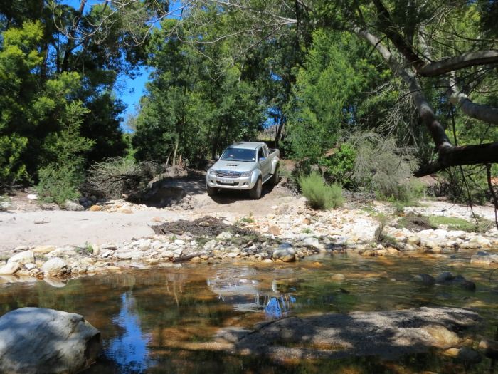
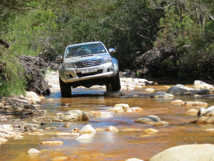


A short stretch of river driving, before we turn up the bank and onto some fine river sand. No match for the massive wheels of the Arctic Toyota though.
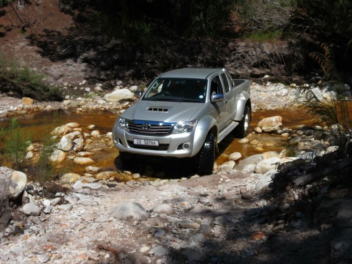


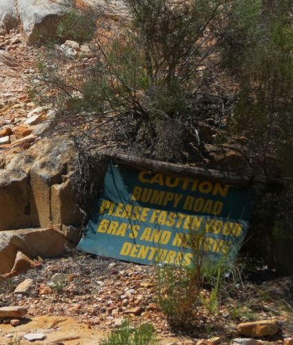
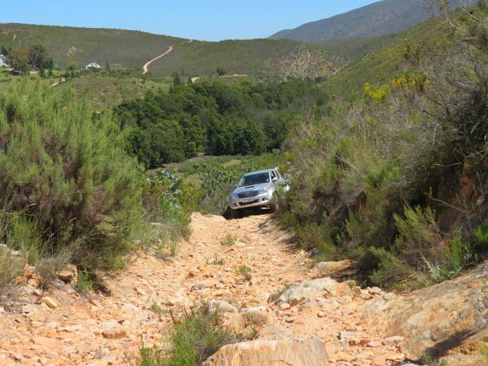
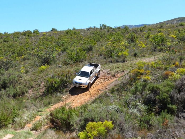
Next you are faced with a steep rocky climb. Being on four wheels this time round it seemed a much less daunting task than when we were here last with our Trail Bikes.
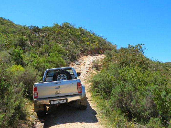


It's a steep climb nonetheless!
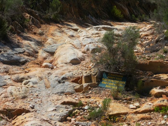


Unfortunately you can't see the true gradient of this climb on the photos (as usual), but the rock is sure underfoot and gives good traction.
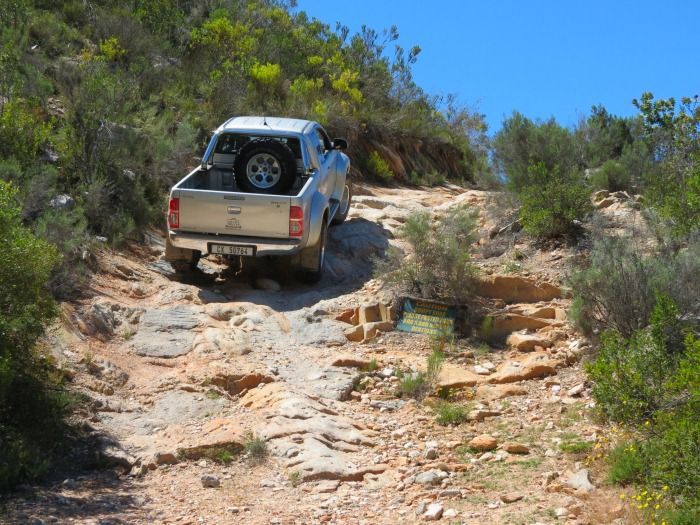
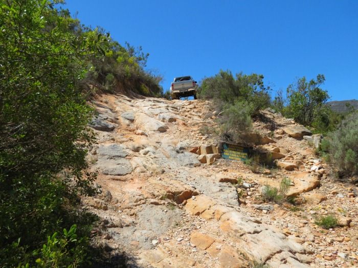


That is not the case on the next section though:
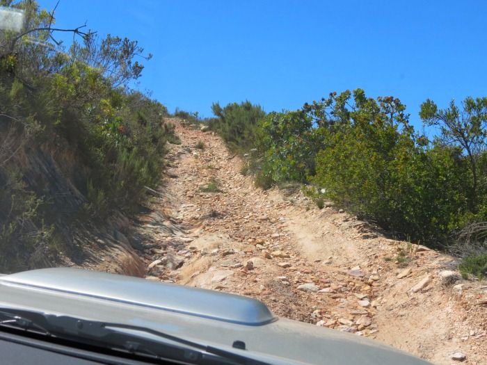


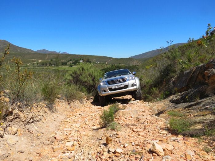
I remember all to well battling up this hill on the motorbikes, one wheel drive with limited traction. It was fun, but also hard work. To the huge footprint of the Arctic 4x4 a hill like this is almost a non-event. Being a biker this almost feels like cheating. Cheesy


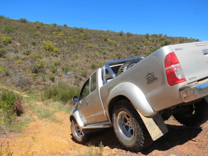
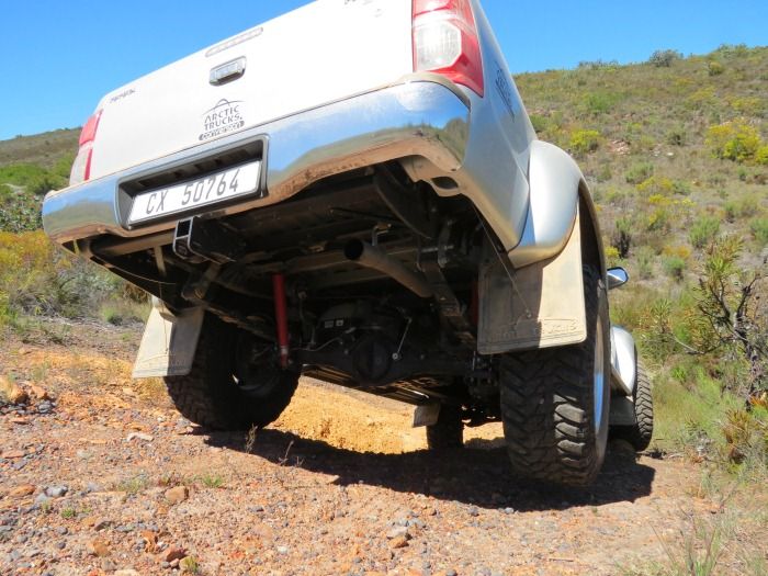
With 290mm ground clearance you don't even have to choose a line. You just crawl up and over whatever is there.
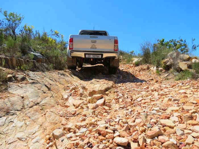


Good articulation ensures that you have traction all the time. Inside the vehicle I was completely oblivious of what was happening underneath, until I saw these photos later.
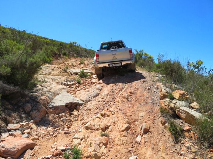
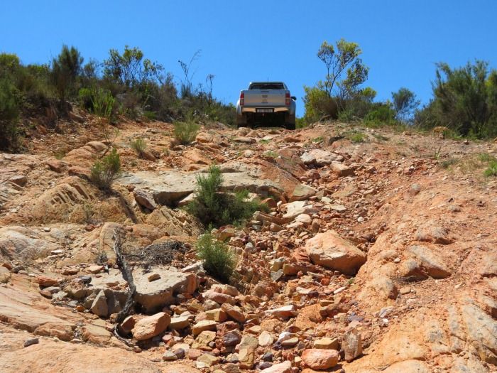


On top the track is in good condition and the route well marked. Time to relax and take in the scenery.
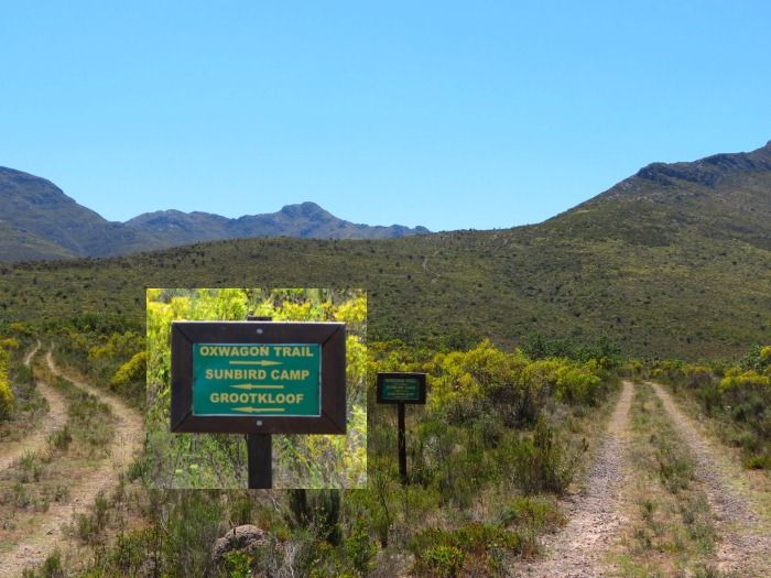


The first European to settle on Bonniedale Farm was a Scotsman in 1860. He had a toll concession to maintain the pass from Bonniedale to the summit of the Attaquas mountains. He also supplied mules, oxen and other produce to passing travellers. This was the Toll house on the right:
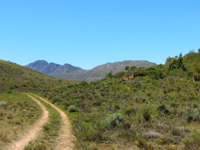
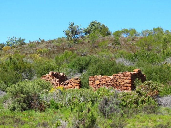


Beautiful scenery, good trail.
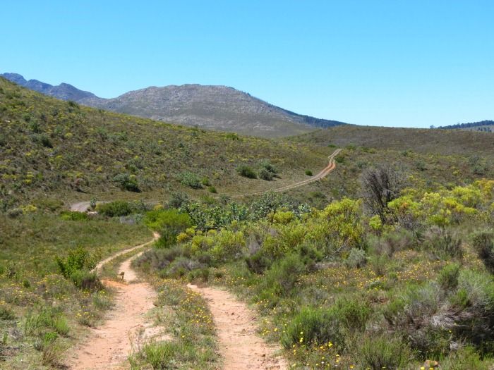


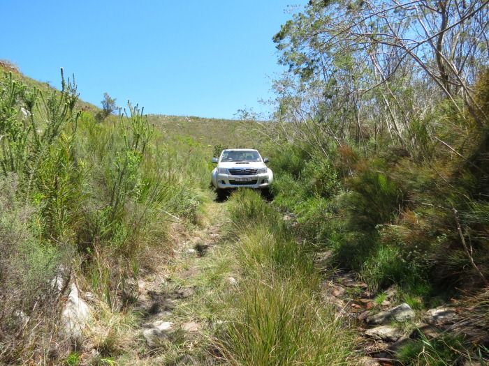
And just when you relax there's a little section that keeps things interesting.
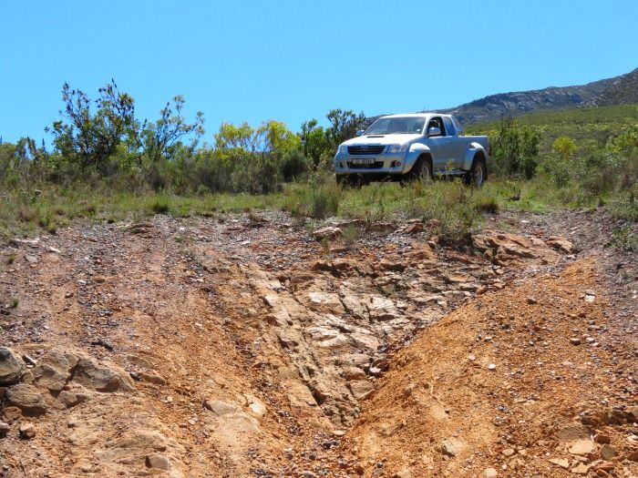


Once again you can not see the true gradient on the photo. I'm sure that for hard core 4x4 enthusiasts this is nothing, but we enjoyed it nonetheless.
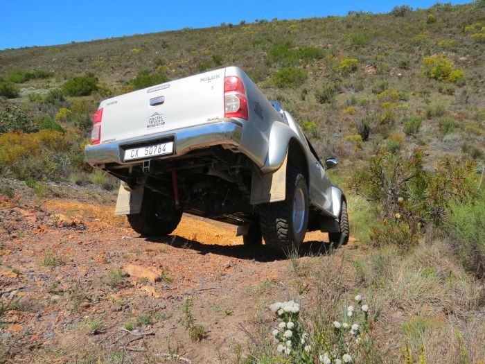


Getting one wheel in the air ever so slightly. That takes some doing in a truck like this.


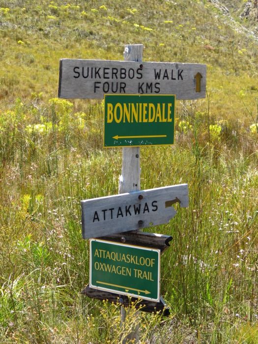
Some route guidence:


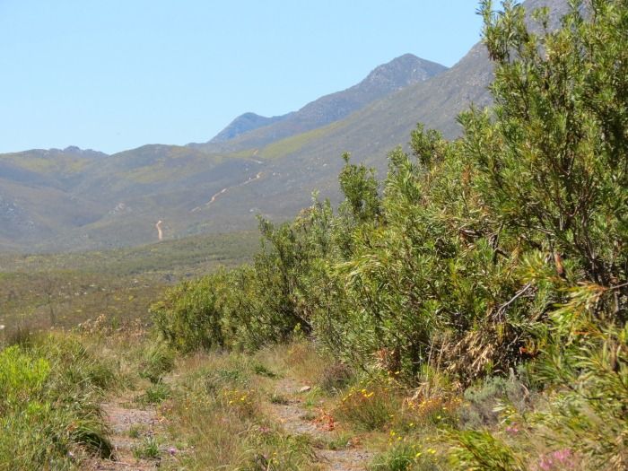
And the pass in the distance:


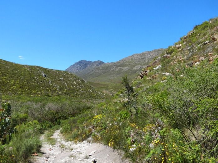
Going through a little kloof - I love the varying conditions and scenery:


And arriving at the Attakwas Hut (also note the large tree):
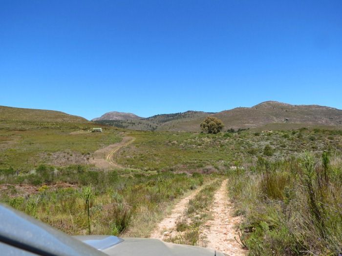


This hut is used by hikers walking along the Attaquas Hiking Trail. It's also the spot of a commemorative plaque for Attaquas Kloof Pass.
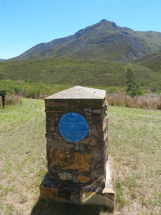
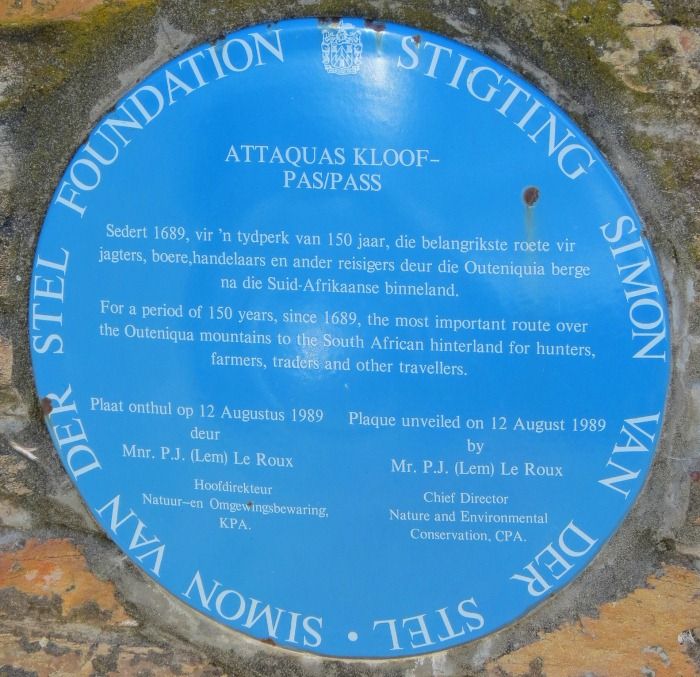


This happens to be the spot where the notorious Bloubaard Swanepoel is burried. He has an unmarked grave near the tree that was fenced off a while back, but the area is quite overgrown now and sadly we could not find it.
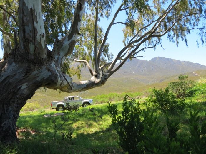


Bloubaard’s claim to fame was the fact that he was the last person to be publicly hanged in South Africa (on the town square in George).

He was convicted on numerous counts of murder of persons who had bought cattle from him. After the sale he would ride over the Attaquas Mountains and ambush them on their way out with cattle, kill them and take the cattle back. He did this on four occasions but on the fifth occasion he did not see one of his potential victims who had gone to the bush to relieve himself.

He is also believed to have killed numerous labourers who took out honey for him on the cliff faces of the upper Gouritz River. After having retrieved the honey from them he would push them off the cliff into a maalgat whirlpool in the Gouritz. As their bodies could never be recovered he could not be convicted on these charges.

A lot of blood flowed in Attaquas kloof. It's hard to marry that ugly truth to the natural splendour found here.
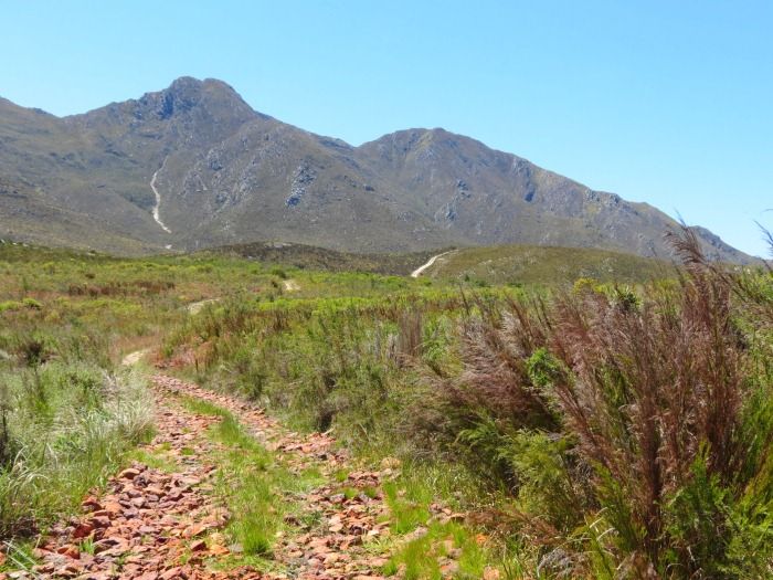


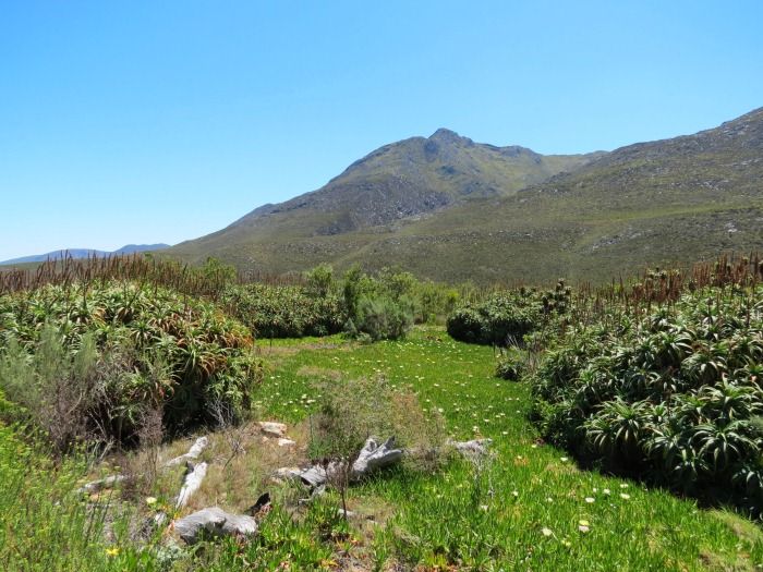
Not far along the trail we find this kraal made by planting Aloes. Oxen were kept safe in this kraal overnight. Amazing how this planted kraal remained in tact after all this time.


The road ahead:
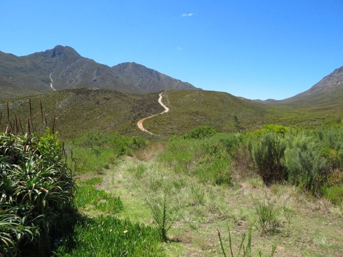


And looking back down from that hill – you see the kraal, the hut in the distance as well as the big tree.
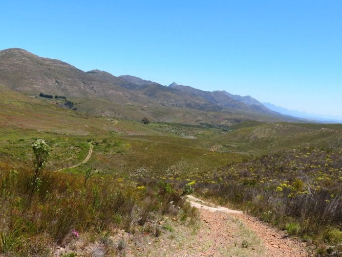


Zoomed in on the Kraal:
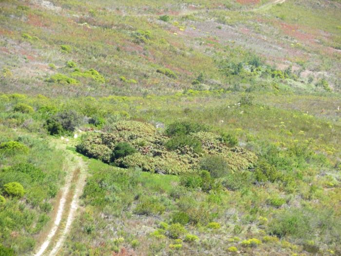


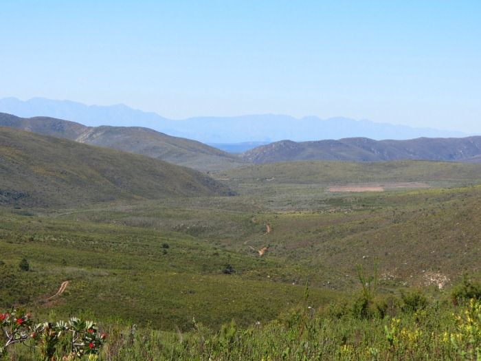
And the view back from further up – a nice view along Attaquas Kloof:
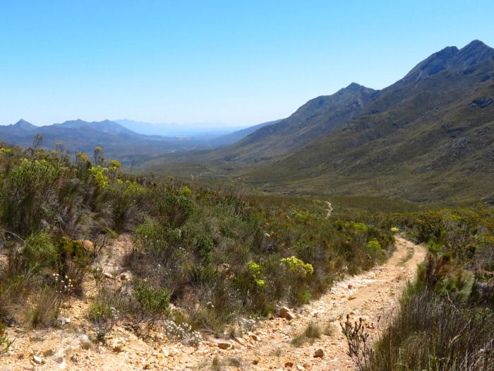


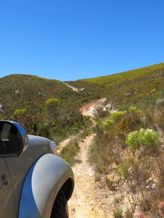
But we are not on top yet!


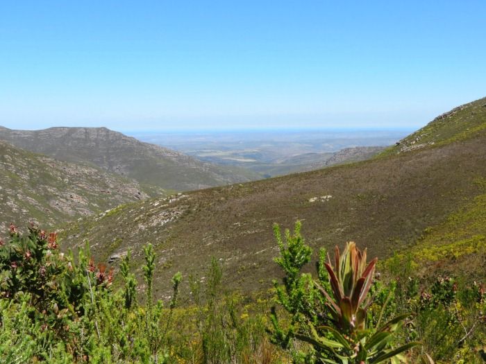
The view once you reach the summit is breathtaking. You can see all the way to the ocean:


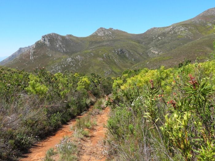
Thick vegetation as you start to decend on the Northern side:


This is where you find a small block house / fort that was built by the English during the Anglo-Boer War.
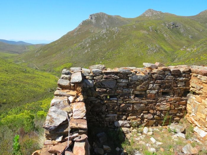


As was the case with Gysmanshoek Pass, the Boer's knew about all these little abandoned passes in the area, so they had to be guarded.
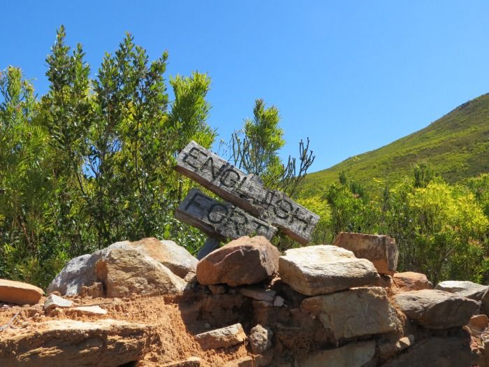


This fort was perfectly placed to guard this pass, with a perfect view on anyone coming up this road.
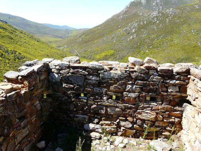
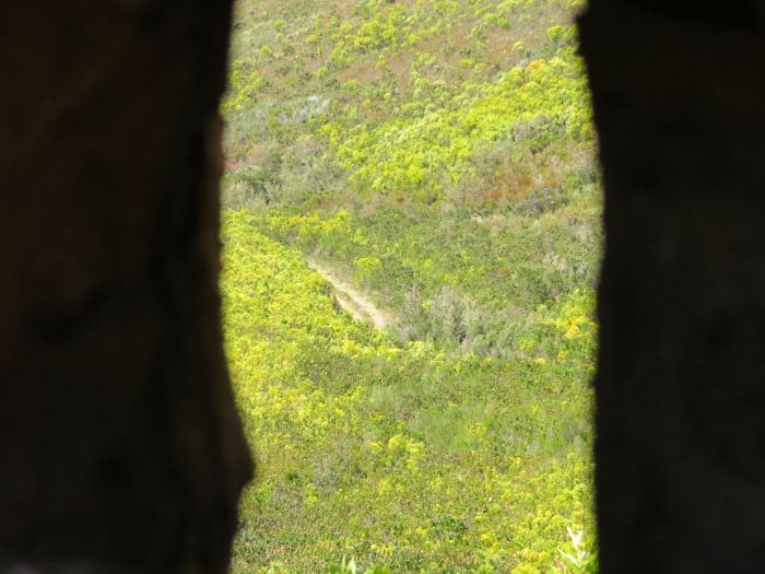
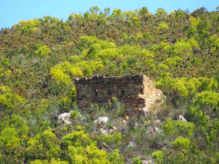


Of course in 1901, while the Anglo-Boer War was raging, this pass has been in disuse for over three decades already. This fort never saw any action (or maybe they just never saw the Boers?).

The last stretch towards “Channa Land”:
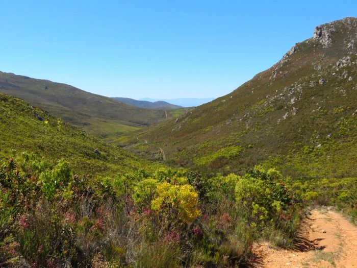


This trail sees little traffic.
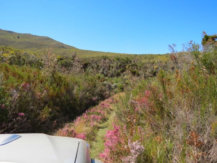


Another monument in honour of the Voortrekkers:
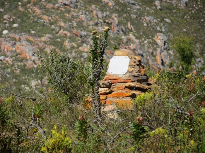


And exiting the reserve, into the Klein Karoo plains.


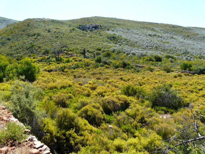
On this side of the pass you find the remains of yet another settlement. This spot had an hotel and general dealer, a perfect stop for travellers before crossing the mountain en route to Mossel bay.

Sadly not much is known today about this settlement. It is situated on the farm Saffraanrivier and the old hotel was apparently called "Die Bonthuis". Rumour has it that there was a murder here and one of the owners hung himself from a tree in front of the hotel, but there are no documented proof of this (that I know of). Sue van Waarts mentions this in one of her books (I am trying to get my hands on a copy). Another writer, Michelle Thompson Raubenheimer, is writing a book on the Raubenheimers of the George/Oudtshoorn area and the farms they lived on. The Raubenheimer family owned Saffraanrivier in the 1800's. I am waiting with bated breath to see what else she unearths.

What remains today:
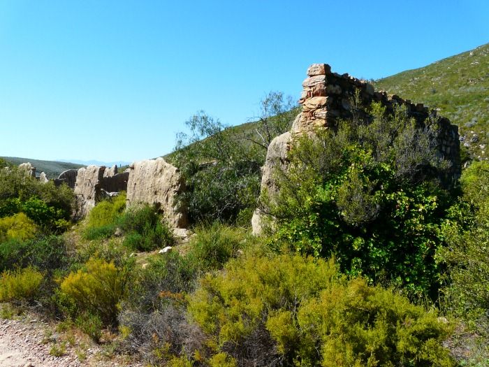


This must be a very old building, build with stone, clay and rubble.
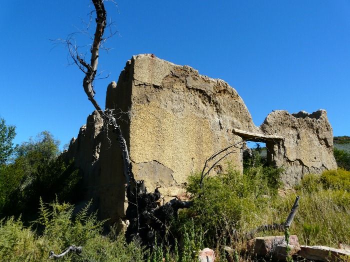


The building next to it seems more modern in comparison and must have been build much later.
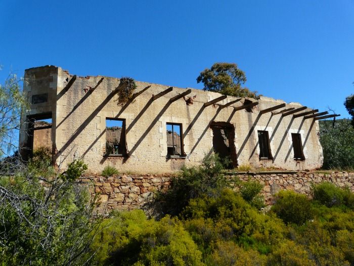


The door on the corner with the plaque above reminds me of the old General dealers? The building style and the block decoration around the windows seems newer? A door that has been closed up in later alterations is also visible.
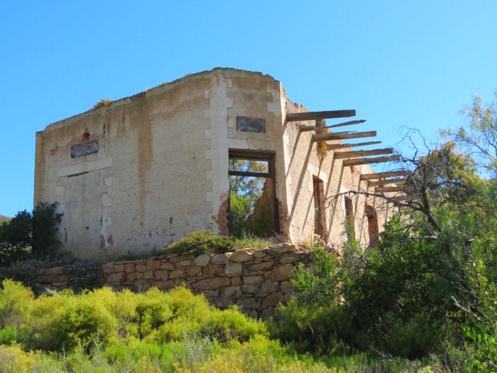
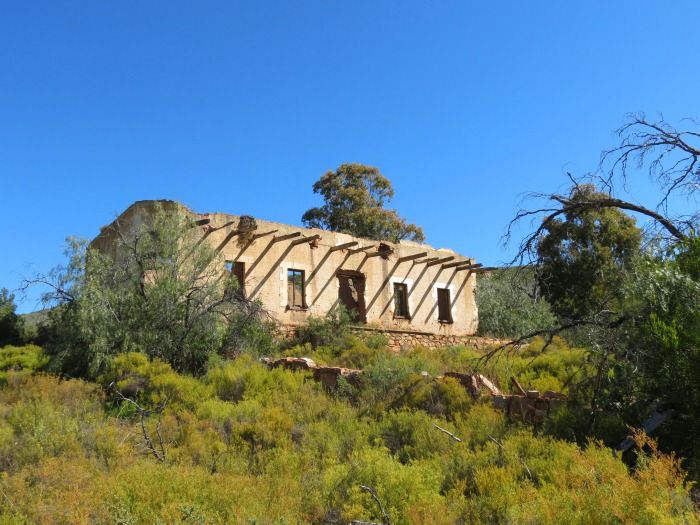
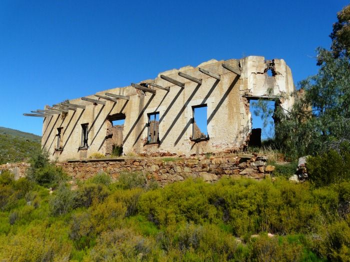


This building had a big courtyard in front, presumable for the parking and loading of ox wagons and such.


Another old building on site:
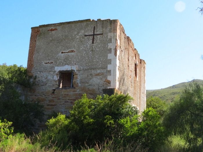


This building was also build with stone, but a second story was added with bricks later.

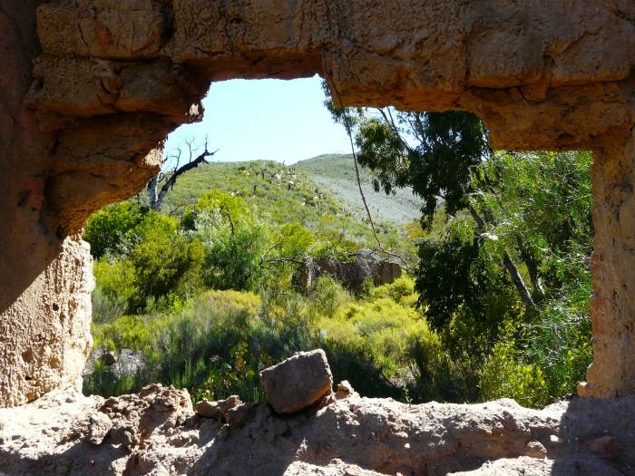
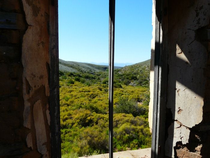
It's fascinating to walk around these old settlements and imagine the daily hustle and bustle that went on here. And today there is nothing but ruins. Such is the way of progress.


Attaquas Pass crosses the mountains a mere six kilometres West of present-day Robinson Pass and this route exits on Robinson pass at  S33 49.079  E22 02.314

Some scenery on the way out:


The whole route (as well as the other 4x4 trails) are mapped on the Tracks 4 Africa maps.

For more information on this route contact Nico and Danette Hesterman of Bonniedale
Holiday Farm on 044-695 3175; e-mail: bonniedale@mweb.co.za or look at their website: www.bonniedale.com
« Last Edit: November 28, 2012, 09:44:07 AM by Trailrider » Logged

“Remember what Bilbo used to say: It's a dangerous business, Frodo, going out your door. You step onto the road, and if you don't keep your feet, there's no knowing where you might be swept off to.”
JC
Sr. Member
****
Offline Offline

Posts: 1453


« Reply #5 on: November 28, 2012, 12:33:46 PM »

Nice.  A1 Louvain se been van die ossewa roetes is afgemerk op my lysie, maar hierdie een moet ek nog doen.

Dunlop SA voer nie meer Cooper bande in nie. Waar kry Arctic Trucks Cooper bande vandaan?
Logged
Trailrider
Administrator
Town Crier
*****
Offline Offline

Posts: 26585


Die Bergie...


WWW
« Reply #6 on: November 29, 2012, 06:58:34 AM »

JC ek sal by hulle hoor. Hulle voer dit waarskynlik in.

Die Louvain deel is al gedoen ek moet dit nog net post. Van die twee passe was ons dit eens dat die een baie interessanter is.
Logged

“Remember what Bilbo used to say: It's a dangerous business, Frodo, going out your door. You step onto the road, and if you don't keep your feet, there's no knowing where you might be swept off to.”
buzzlightyear
Administrator
Village Elder
*****
Offline Offline

Posts: 4394


I come in pieces


WWW
« Reply #7 on: November 29, 2012, 02:29:23 PM »

Baie baie nice. Ek raak sommer lus om Bonniedale toe te ry  Smile

Het vandag vir my 'n knobbly bestel vir die trip soontoe Des.
Logged

A desk is a dangerous place from which to watch the world. - John LeCarré
Trailrider
Administrator
Town Crier
*****
Offline Offline

Posts: 26585


Die Bergie...


WWW
« Reply #8 on: December 04, 2012, 11:34:42 AM »

When Attaquas pass was first crossed in 1689 it was the only route linking the coastal belt to the Klein Karoo. The likes of Gysmanshoek pass (1740) was still half a century in the future. The mountain ranges was not the only natural barrier isolating the coastal area though. It was often divided into further sections by rivers running into the ocean. One such barrier, perhaps the most fearsome of all, was Kaaimansgat. Getting a wheeled vehicle through Kaaimansgat was close to impossible. This meant that the timber and fish-rich lakes area was not only cut off from George and the harbour in Mossel bay, but also from the Klein Karoo. Another pass was needed.

Duiwelskop Pass could have been a relative “tame” pass considering what some of the other passes are like, but due to the means of travel at the time this pass ran over the summit of on of the peaks of the mountain range. This was because the tall wagons could not handle steep side slopes and would topple over, so straight up the one side and straight down the other was the only way to go. Those were the days of men.

The pass was aptly named Duiwelskop Pass, and this is the next section of our route. We start our journey on the Klein Karoo side on the farm Louvain, where we obtain our permits and keys for this section of our route from a very helpful Nico Bester. The permit cost is included in the route cost of R200 per vehicle and allows entry into the Bergplaas Forestry station area at the end of the trail.

The forestry section has a very definite and strict "No Bikes" policy and therefore I have never been on this pass before. I do not have that problem today though because today my set of wheels is this – an Arctic Amarok!


There's a lot to be said for travelling where you have not been before. First-time experiences, new things to see. I am running out of places like that in the Southern Cape, so I could hardly contain my excitement.

The route is well marked and soon we were on our way.


The maintained roads of the first day is now a distant memory as the start of this route promisses more of the same conditions we encountered on Attaquas Pass.


No problem for the Arctic Amarok though as it takes it in it's stride.

The first section runs straight up the mountain as can be seen with the erosion on the road. Might be a different kettle of fish traveling up here when it's raining...


As you start to gain some height the scenery and view gets better and better.


Sometimes you dip into an overgrown area...


only to emerge again and be treat to more spectacular views.


And we were not even halfway up yet! Some serious climbing still lay ahead...


As per usual you can not see the true gradient on the photos, and add to that an uneven road and any 4x4 vehicle has it's work cut out. Traction is the name of the game here.


This is a cross-axle situation. Going through it the front wheel lifts and when it comes down the back wheel lifts.


Check the amazing articulation of this Amarok:


When a truck hangs on three wheels the articulation pretty much goes as far as it can and the big wheels never touched the arches.

The Motor Journalist in me desperately wanted a standard Amarok here too to compare. The big wheels and upgraded suspension, coupled with VW's 4Motion system makes for one impressive vehicle.


The view back over the Langkloof from higher up:


And higher still – gaining some real altitude now.


And we're not on top yet!


And finally (but all to soon) we summit – on top of the world.


The view in all directions from here is simply amazing.


Along the mountain range looking East:


The view towards the ocean:


It is thought that local farmers, Jacobus van Beelen and Stephanus Terblanche, opened this route in 1772, but is thought that the public only started using this pass in 1776. It was the first pass opened over the Outeniqua mountains from North to South. The fact that people were prepared to travel West from George, over Attaquas Pass, down the Langkloof and over Duiwelskop Pass is a clear indication of what a big obstacle Kaaimansgat was considered to be.

Sir John Barrow, who passed this way in 1797, commented:

From the one end of the Lange kloof there is but one passage for wagons over the South chain of mountains and this is seldom made use of, being considered among the most formidable and difficult roads in the colony. It lies, in fact, over the very summit of one of the points in the chain called the Duivels Kop...

...the road was dreadfully steep and stony, and as it approached the summit, where the width of the ridge was not above fifteen paces, the ascent was from stratum to stratum of rock, like a flight of stairs, of which some stairs were not less than four feet high. Upon these it was necessary to lift the wagons by main strength... The descent of the Duyvil's Kop was much more gradual than the ascent, and the smooth grassy surface of the Northern side was now changed into an extensive shrubbery.


Four foot steps with an ox-wagon.


The road down the Southern side:


This section too has it's moments. I can not imagine how the people of the time negotiated these passes with wagons and oxen that had almost no suspension to speak of and needed wide turning circles.


Some more scenery shots on the way down:


Coming down onto the coastal plain the Flora changes totally from the Karoo fynbos to lush forest and ferns.


The end of the route deposits you right onto the George / Knysna 7 passes road near Hoekwil.

The great road builder Andrew Bain did have a look at this pass in 1857, as did his son Thomas Bain in 1862, but it was never improved. The construction of the 7 passes road between George and Knysna negated the need for this pass and it fell into disuse.

It never was busy route like Attaquas Pass, so there are no ghost towns of years gone by. I am surprised though that there is not even a Block house, as the Boers under Gideon Scheepers did make quite a nuisance of themselves in the Langkloof. It is spectacular to travel though, the scenery alone is breathtaking.

Like Attaquas Pass, this pass can also be found on the Tracks 4 Africa maps. Also have a look at the Louvain Website for more info.
Logged

“Remember what Bilbo used to say: It's a dangerous business, Frodo, going out your door. You step onto the road, and if you don't keep your feet, there's no knowing where you might be swept off to.”
buzzlightyear
Administrator
Village Elder
*****
Offline Offline

Posts: 4394


I come in pieces


WWW
« Reply #9 on: December 04, 2012, 12:05:00 PM »

Baie mooi! Dankie!  Cool
Logged

A desk is a dangerous place from which to watch the world. - John LeCarré
JC
Sr. Member
****
Offline Offline

Posts: 1453


« Reply #10 on: December 04, 2012, 06:50:44 PM »

Dit is inderdaad puik wiel artikulasie. Die feit dat jy kon stop teen daai helling om foto's te neem en weer wegtrek (ek neem so aan), vertel ook baie van die artikulasie.

Ek het op pad na my kamp vakansie met 'n volgelaaide bakkie en 'n off-road waentjie agteraan die roete gedoen. Die Isuzu het nie naastenby hierdie tipe suspensie beweging nie en ek moes momentum behou om deur daai haarnaald te kom. Dit was nogal 'n "scary" ervaring.

Nice verslag.

« Last Edit: December 05, 2012, 07:33:20 PM by JC » Logged
Trailrider
Administrator
Town Crier
*****
Offline Offline

Posts: 26585


Die Bergie...


WWW
« Reply #11 on: December 04, 2012, 07:09:03 PM »

JC daai Amatrokkie is AWESOME. Die Arctic ombouing verrig wondere. Dis bitter jammer ek sal seker nooit een kan besit nie.


Jy is daar oor met 'n boswa? Respect! Cool
Logged

“Remember what Bilbo used to say: It's a dangerous business, Frodo, going out your door. You step onto the road, and if you don't keep your feet, there's no knowing where you might be swept off to.”
Pages: [1]   Go Up
Print
Jump to: